Upper Mustang Trek Altitude: Elevation, Acclimatization & Risks Explained
RRojan BasnetAugust 29, 2026
Local trekking experts, wherever you go
Trips planned around your pace, interests, and time.
Real People, Quick and Helpful Support

Complete breakdown of Upper Mustang trek distance, total kilometers, daily walking hours, elevations, permits and route to Lo Manthang. Plan your 2026 trek.

Complete 2026 guide to reaching Upper Mustang: Pokhara-Jomsom flights, jeep routes, RAP permit rules, costs, and the best monsoon trekking window explained.

Complete Upper Mustang weather guide: monthly temperatures, rainfall, wind, and the rain-shadow monsoon window. Plan your Lo Manthang trek right.
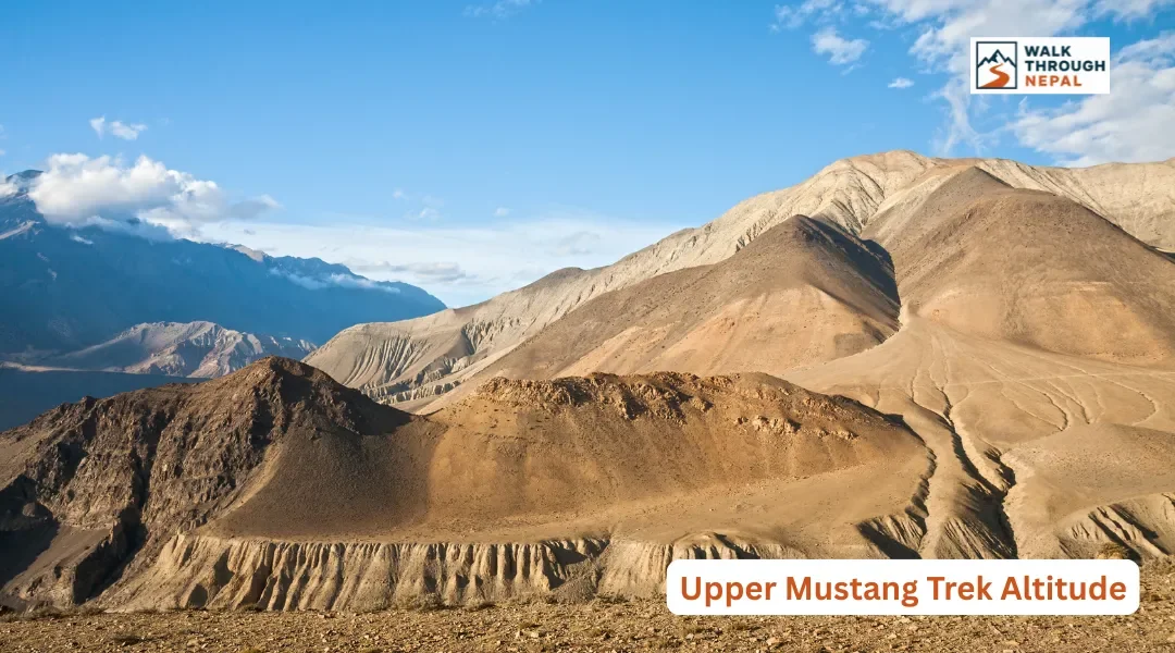
The wind hits you first. Long before you reach the walled city of Lo Manthang, the trail through Upper Mustang teaches you that this is a high desert, not a green valley. Dust devils spin across ochre cliffs, ancient sky caves pockmark the ridgelines, and the thin dry air makes every uphill push feel a touch harder than the map suggests.
Understanding the altitude profile of this trek is the single most useful thing you can do to prepare. Below you will find the real elevation numbers, a safe acclimatization plan, and honest detail on the risks unique to this high desert kingdom.
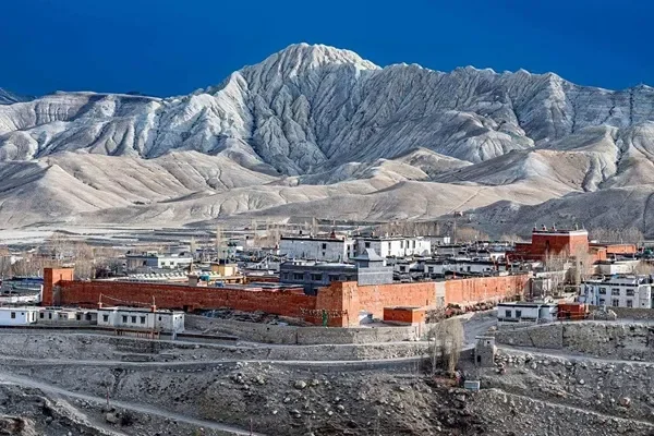
The Upper Mustang trek ranges from 2,800 meters at Kagbeni to a maximum sleeping elevation of 3,840 meters at Lo Manthang. The highest pass on the standard route sits close to 3,932 to 3,950 meters, and the highest point on the optional eastern return via Chogo La reaches roughly 4,280 to 4,325 meters.
Because you never sleep above 3,900 meters on the standard route, Upper Mustang carries a lower altitude-illness risk than most classic Himalayan treks. The bigger challenge here is not extreme height but the relentless dry wind, intense sun exposure, and the cumulative fatigue of walking day after day on dusty desert terrain.
Here is a village-by-village altitude breakdown so you can see where the climbing actually happens. The trail undulates constantly, often gaining several hundred meters only to drop back down to a river valley before the next overnight.
Location | Elevation | Change from Previous Stop | Role on Trek |
|---|---|---|---|
Jomsom | 2,720 m | Start point | Flight hub / trek start |
Kagbeni | 2,800 m | +80 m | Gateway checkpoint to restricted zone |
Chele | 3,050 m | +250 m | First overnight inside Upper Mustang |
Syangboche | 3,800 m | +750 m | Steepest single-day gain on the route |
Ghami | 3,520 m | -280 m | Overnight village, drops into a valley |
Tsarang (Charang) | 3,560 m | +40 m | Overnight village with a major monastery |
Lo Manthang | 3,840 m | +280 m | Walled capital, highest sleeping point |
Nyi La / Lo La (naming varies by operator) | ~3,932-3,950 m | Crossed en route | Highest pass on the standard out-and-back |
Chogo La (eastern return only) | ~4,280-4,325 m | Optional route | Highest point if you take the eastern loop |
The Syangboche day is worth flagging on its own: a 750 meter gain in a single day is the steepest climb on the standard itinerary, and it is where trekkers most often feel the altitude for the first time.
Upper Mustang tops out lower than Everest Base Camp's 5,364 meters and stays well below the Annapurna Circuit's Thorong La at 5,416 meters. If you are weighing the two routes, our Annapurna Circuit altitude guide breaks down that profile in the same detail. In pure elevation terms, Upper Mustang is a moderate trek. What makes it feel harder than the numbers suggest is the exposure: long stretches of shadeless desert trail where wind and sun do more damage than the altitude itself.
This is also why Upper Mustang suits trekkers recovering from a prior altitude scare, or those wanting Himalayan scenery without the lung strain of a 5,000-plus-meter pass. The trade-off is that it demands more sun and wind protection than a typical forested Himalayan route.
Safe acclimatization means sleeping elevation should not rise more than 300 to 500 meters per day once you cross 3,000 meters. On this route, the natural day-by-day profile does much of this work for you, and a rest day at Lo Manthang is built into every responsible itinerary.
The daily pattern of climbing over a ridge or pass and then descending into a river valley to sleep gives your body a built-in "climb high, sleep low" rhythm. This is one reason the route feels physically demanding on the legs yet stays relatively altitude-friendly on the lungs.
Walk slowly and steadily, especially above 3,800 meters. Drink at least three to four liters of water daily, since the arid climate dehydrates you faster than a humid mountain trail would. Treat every headache seriously and tell your guide immediately rather than pushing through it. Wind and sun protection matter as much as pacing here, so check our Upper Mustang packing list before you go.
Spend a full acclimatization day inside the walled city at 3,840 meters. Use it to walk the short uphill trails out to the Chhoser sky caves and Namgyal Monastery, which lets your body adapt while keeping your sleeping elevation stable rather than gaining net height.
This active-rest approach, staying at the same sleeping elevation while doing light activity, works better for acclimatization than spending the whole day resting in a lodge.
Acute Mountain Sickness can appear above 2,500 meters, so even Upper Mustang's moderate heights deserve respect. Early signs include headache, nausea, dizziness, loss of appetite, and disturbed sleep. The rule that matters most: if symptoms worsen, do not ascend further, and if they still worsen, descend.
Because maximum sleeping height stays under 3,900 meters, severe conditions like High Altitude Pulmonary Edema (HAPE) and High Altitude Cerebral Edema (HACE) are rare on this route. Rare is not the same as impossible, though, and the remoteness of the region means help can be hours away. Your guide carries responsibility for monitoring the whole group daily.
Standard travel insurance is not enough for this trek. You need a policy that specifically covers high-altitude emergency helicopter evacuation up to 6,000 meters and medical treatment for AMS, HAPE, and HACE. This coverage is not optional paperwork, it is legally required to obtain your Restricted Area Permit.
Keep a printed copy of your policy and the 24-hour emergency assistance number with your guide. In Upper Mustang, a helicopter from Pokhara or Jomsom is often the only realistic way out of a serious medical situation.
Upper Mustang requires the Restricted Area Permit (RAP) at USD 500 for 10 days (USD 50 per extra day) plus the ACAP permit at NPR 3,000, alongside a mandatory licensed guide. For the full permit process, solo traveler rules, and guide requirements under the 2026 update, see our Upper Mustang trek page.
Upper Mustang sits in the Himalayan rain shadow behind the Annapurna and Dhaulagiri massifs, keeping it dry and walkable during the June to August monsoon when most of Nepal is muddy. See our guide on which Nepal treks stay safe during monsoon for how Upper Mustang compares to other routes in that window. At altitude here, that dryness cuts both ways: clear skies but also intense unfiltered sun at 3,500 meters and above.
Spring and autumn bring the clearest mountain views but also the strongest winds, which build through the morning and peak by early afternoon at the higher villages. We recommend starting each day's walk early and aiming to reach the next village before the afternoon wind and dust build at elevation. For the fuller seasonal picture across Nepal, see our best time to visit Nepal guide.
The highest sleeping point is Lo Manthang at 3,840 meters. The highest pass on the standard route sits near 3,932 to 3,950 meters, rising to roughly 4,280 to 4,325 meters if you take the optional eastern return via Chogo La.
No. Upper Mustang tops out well below EBC's 5,364 meters. The difficulty here comes from wind, sun, and dust rather than extreme height or thin air at very high passes.
The climb from Chele to Syangboche, a 750 meter gain in a single day, is the steepest on the standard itinerary and where altitude is most often first felt.
Yes. A rest day at Lo Manthang (3,840 meters) is standard practice, using light activity like the Chhoser caves walk rather than full inactivity.
At least three to four liters daily. The dry desert air dehydrates you faster than the altitude itself.
The risk is lower than on Everest or Annapurna since sleeping elevations stay under 3,900 meters, but AMS can still appear above 2,500 meters, so standard precautions still apply.
They are rare given the moderate sleeping elevations, but not impossible. Guides monitor the group daily, and descent is the standard response if symptoms worsen.
Yes. Standard travel insurance does not cover high-altitude helicopter evacuation. You need a policy covering evacuation up to 6,000 meters and AMS, HAPE, and HACE treatment, which is legally required for the permit.
Wind and sun exposure on the largely shadeless desert trail add fatigue on top of the altitude itself, which is why the trek can feel harder than its modest elevation numbers imply.
Operators name this pass differently depending on the exact route segment, and cited elevations range from about 3,932 to 3,950 meters. Confirm the specific name and height with your guide, since it varies by itinerary.
Trekkers with reasonable fitness and no history of severe AMS generally do well here, given the moderate elevations and built-in acclimatization rhythm. Anyone with a prior HAPE or HACE episode should consult a doctor before booking. If you are weighing Upper Mustang against other options, see our roundup of the best treks in Nepal for beginners.
The elevations stay the same year-round, but wind intensity at altitude is typically strongest in spring and autumn, while summer's rain-shadow dryness brings calmer but still sun-intense conditions.
Upper Mustang rewards trekkers who respect its rhythm rather than its raw numbers. At 2,800 to 3,932 meters, the elevation profile is genuinely moderate next to Everest or the Annapurna Circuit, yet the dry wind, relentless sun, and long undulating days make it feel harder than the figures suggest. The route's built-in "climb high, sleep low" pattern does much of the acclimatization work for you, provided you pace the Syangboche climb, hydrate seriously, and take the Lo Manthang rest day seriously rather than skipping it. Pair that pacing with proper insurance and a licensed guide who knows the terrain, and Upper Mustang becomes one of the more forgiving high-altitude routes in Nepal rather than one of the riskier ones.
Ready to Trek Nepal?
If you are ready to walk into the walled city of Lo Manthang, our verified local guides can handle your permits, acclimatization plan, and safety logistics. Browse our Upper Mustang trek itinerary or the Upper Mustang tour option, and connect with our team to start planning a safe trek.
