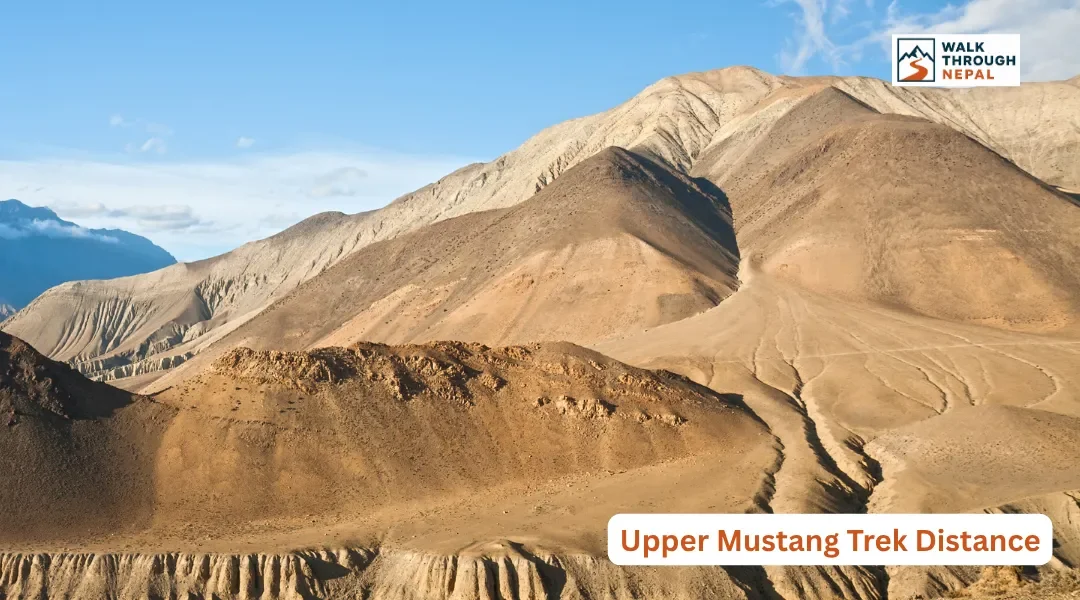
Upper Mustang Trek Distance: Total Kilometers, Daily Walks & Route Guide
RRojan BasnetAugust 29, 2026
Local trekking experts, wherever you go
Trips planned around your pace, interests, and time.
Real People, Quick and Helpful Support

Complete Upper Mustang trek altitude guide: elevations, acclimatization tips, AMS risks, permits & 2026 rules. Plan a safe journey to Lo Manthang.

Complete 2026 guide to reaching Upper Mustang: Pokhara-Jomsom flights, jeep routes, RAP permit rules, costs, and the best monsoon trekking window explained.

Complete Upper Mustang weather guide: monthly temperatures, rainfall, wind, and the rain-shadow monsoon window. Plan your Lo Manthang trek right.
Ask ten different websites how far Upper Mustang actually is, and you will get ten different answers. Some quote the drive from Jomsom, some quote the full loop from Kagbeni, and almost none of them separate walking kilometers from jeep kilometers. That gap is what trips up trekkers once they are standing on the trail, staring at a ridge that looked flat on paper.
Below you will find the total trek distance, a full day-by-day breakdown of kilometers, walking hours, and elevation change, plus how the route stacks up against other Nepal treks.
The classic Upper Mustang trek covers roughly 160 to 180 kilometers (99 to 112 miles) round trip when walked from Kagbeni to Lo Manthang and back. Starting from Jomsom adds about 9 kilometers (5.6 miles) each way. Most trekkers walk 8 to 12 days, averaging 12 to 20 kilometers (7.5 to 12.4 miles) and 5 to 7 hours daily across dry high-desert trail.
The total distance shifts depending on three things: whether you begin at Jomsom or drive straight to Kagbeni, whether you use the jeep road on the return leg, and how many side excursions you add. A rough jeep road now reaches all the way to Lo Manthang, so many groups walk the traditional trail on the way up and take vehicles for part of the descent. We recommend prioritizing the older walking paths on the western side to escape the dust and vehicle traffic that the main road brings.
The standard 14-day walking itinerary starts at Kagbeni (2,800 m), the gateway checkpoint into the restricted zone, and climbs north to Lo Manthang (3,840 m). Daily segments run between 12 and 20 kilometers, with net elevation change telling you more about the day's difficulty than distance alone.
Day | Route Segment | Distance | Walking Time | Elevation Change | Max Elevation |
|---|---|---|---|---|---|
1 | Jomsom to Kagbeni | 9 km (5.6 mi) | 3-4 hrs | -80 m net descent | 2,810 m |
2 | Kagbeni to Chele | 16 km (9.9 mi) | 6-7 hrs | +240 m net ascent | 3,050 m |
3 | Chele to Syangboche | 18 km (11.2 mi) | 6-7 hrs | +750 m ascent / -300 m descent | 3,800 m |
4 | Syangboche to Ghami | 14 km (8.7 mi) | 5-6 hrs | -280 m net descent | 3,520 m |
5 | Ghami to Tsarang | 13 km (8.1 mi) | 5 hrs | +40 m net ascent | 3,560 m |
6 | Tsarang to Lo Manthang | 16 km (9.9 mi) | 5-6 hrs | +280 m net ascent | 3,840 m |
7 | Lo Manthang & Chhoser caves (day walk) | 14 km (8.7 mi) | 5 hrs | +60 m ascent, no net gain | 3,900 m |
8 | Lo Manthang to Dhakmar (via Ghar Gompa) | 19 km (11.8 mi) | 6-7 hrs | -20 m net, rolling terrain | 3,820 m |
9 | Dhakmar to Chhusang | 17 km (10.6 mi) | 6 hrs | -840 m net descent | 2,980 m |
10 | Chhusang to Jomsom | 18 km (11.2 mi) | 6-7 hrs | -260 m net descent | 2,720 m |
Notice that the terrain is not a steady climb. You cross several passes above 3,700 meters on multiple days, dropping into river valleys and climbing back out within the same afternoon. This constant up-and-down is what makes the modest daily kilometers feel more taxing than the numbers alone suggest, especially once the afternoon wind picks up.
The route begins at Kagbeni, follows the Kali Gandaki riverbed north, then climbs through Chele, Syangboche, Ghami, and Tsarang before reaching the walled city of Lo Manthang. The return typically loops west through Ghar Gompa and Dhakmar's red cliffs, staying between 2,800 and 3,900 meters throughout.
From Kagbeni the trail hugs the Kali Gandaki, the deepest river gorge on earth, before a checkpoint stamps you into the restricted zone. Beyond Chele the landscape turns fully Tibetan: barley terraces, chortens painted in red and white, and long mani walls lining the path. Always pass these clockwise, keeping the wall on your right.
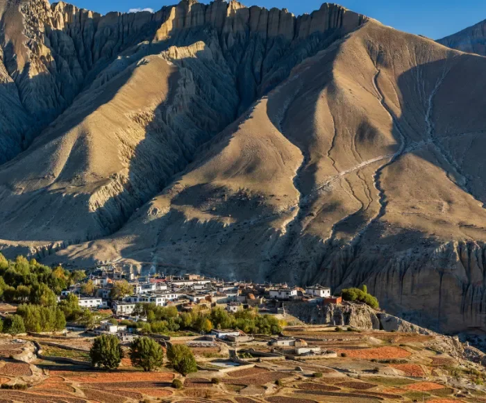
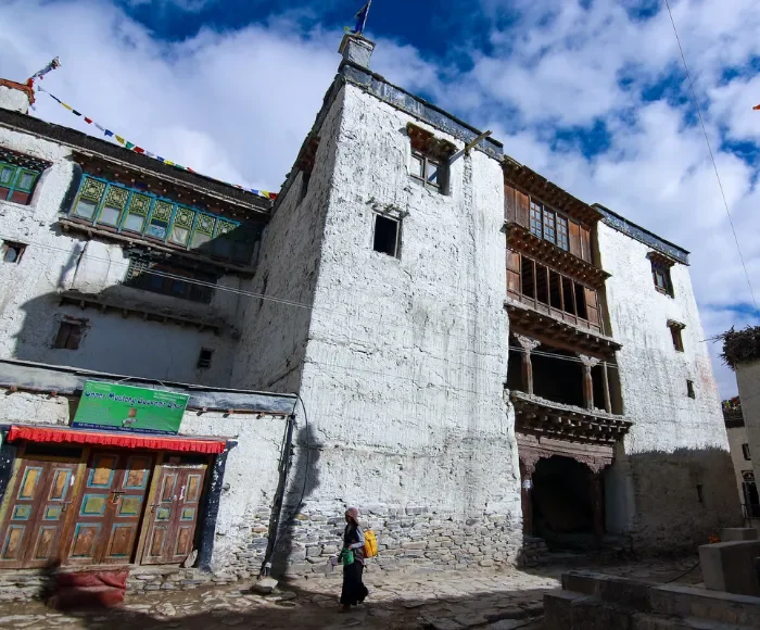
The high point of the walking route sits near the Nyi La and Ghami La passes at roughly 3,800 meters. Lo Manthang itself, the medieval walled capital of the old kingdom of Lo, holds ancient monasteries whose murals rank among the finest surviving Tibetan Buddhist art anywhere.
Your final distance total depends heavily on which add-ons you include. The Jomsom start adds roughly 18 kilometers (11.2 miles) round trip compared to beginning at Kagbeni. The Chhoser sky caves side trip from Lo Manthang adds about 14 kilometers (8.7 miles) as a single-day out-and-back, already reflected in Day 7 above.
The eastern loop through Dhi and Yara, which extends toward the Damodar Kunda area, is the biggest variable. This detour can add 20 to 30 kilometers (12.4 to 18.6 miles) and 2 to 3 extra trekking days depending on how far you push toward the sacred lake. Trekkers who combine the Jomsom start, the Chhoser caves, and a partial eastern loop routinely see totals climb past 190 kilometers (118 miles), which is why generic "distance" numbers online vary so widely.
The jeep road that now reaches Lo Manthang cuts the return distance dramatically. Walking the full return from Lo Manthang to Jomsom takes roughly 4 days and 68 kilometers (42.3 miles) along the itinerary above. Driving the same stretch takes 6 to 8 hours depending on road conditions, covering a similar road distance in a single day.
This is not a straight swap, though. The jeep road and the traditional walking trail are not the same path in several sections, and the road brings dust and vehicle traffic that the older NATT-style trails avoid. If your goal is walking distance and trail experience rather than simply reaching Lo Manthang and back, we recommend walking both directions and treating the jeep option as a weather or time-shortage backup rather than the default plan.
At 160 to 190 kilometers over 8 to 12 walking days, Upper Mustang sits in the middle range of Nepal's major treks. The Annapurna Circuit, by comparison, covers roughly 160 to 230 kilometers depending on the start and end points and whether you include the Poon Hill extension, spread across 12 to 18 days. Everest Base Camp runs shorter at roughly 130 kilometers round trip from Lukla, but over similar 10 to 12 day timelines because the terrain forces a slower pace at altitude.
What sets Upper Mustang apart is not the raw kilometers but the terrain type. Where Everest and Annapurna gain and lose large elevation on forested or rocky mountain trail, Upper Mustang's distance is walked across high desert plateau and canyon, where wind resistance and sun exposure, not steep gradient, are what slow you down.
Upper Mustang stays below 4,000 meters at sleeping elevations, so severe altitude sickness is less common here than on Everest or the Annapurna Circuit. Still, standard safety applies: above 3,000 meters, sleeping elevation should not rise more than 300 to 500 meters per day, and the itinerary above builds in a rest day at Lo Manthang.
The Lo Manthang exploration day doubles as acclimatization. You can walk out to the Chhoser sky caves, ancient dwellings carved into vertical cliffs, without gaining net sleeping altitude, which is exactly why that day's distance is added without pushing your elevation ceiling higher.
Upper Mustang is one of the few Nepal treks that shines in summer. Lying in the Himalayan rain shadow behind the Annapurna and Dhaulagiri massifs, it stays dry and walkable during the June to August monsoon, when trail conditions elsewhere in Nepal turn to mud.
Spring (March to May) and autumn (September to November) offer the clearest skies for the long views across the canyon country, but also bring the strongest afternoon winds, which slow walking pace on the exposed stretches between Chele and Syangboche in particular. Winter is walkable but cold, and daylight hours cut your usable walking window shorter, which can affect how you space out the daily distances above.
Upper Mustang is a Restricted Area requiring the special RAP permit plus the ACAP permit, and a licensed guide is mandatory regardless of group size under current 2026 rules.
The Kagbeni-to-Lo Manthang round trip runs roughly 160 to 180 kilometers (99 to 112 miles), with Jomsom starts adding about 18 kilometers (11.2 miles).
Plan for 10 to 14 days total including travel, with 8 to 12 walking days.
The route peaks near the passes around 3,800 meters; Lo Manthang sits at 3,840 meters.
No. The route crosses multiple passes above 3,700 meters with steep drops into river valleys between them, so daily elevation change varies more than daily distance.
About 14 kilometers (8.7 miles) as a single-day out-and-back from Lo Manthang.
It can add 20 to 30 kilometers (12.4 to 18.6 miles) and 2 to 3 extra days, depending how far you go.
Yes. The jeep road reaches Lo Manthang and cuts the multi-day return walk to a single 6 to 8 hour drive, though it follows a different path than the traditional trail in places.
Upper Mustang covers 160 to 190 kilometers, while the Annapurna Circuit runs 160 to 230 kilometers depending on route variations, over a longer 12 to 18 day timeline.
EBC covers roughly 130 kilometers round trip, shorter than Upper Mustang, but both take similar total trekking days because of altitude-driven pacing.
Yes. High-altitude sun and constant afternoon wind across exposed desert terrain make daily distances feel longer than the same kilometers would at lower elevation.
Less than on Everest or Annapurna, since sleeping elevations stay under 4,000 meters, but standard acclimatization pacing still applies above 3,000 meters.
Summer, because Upper Mustang sits in the Himalayan rain shadow and stays dry when the rest of Nepal is in monsoon. Spring and autumn have clearer views but stronger winds.
If you are ready to walk this route yourself, connect with our verified local guides to build an itinerary around your pace, season, and add-ons like the Chhoser caves or the eastern loop.
